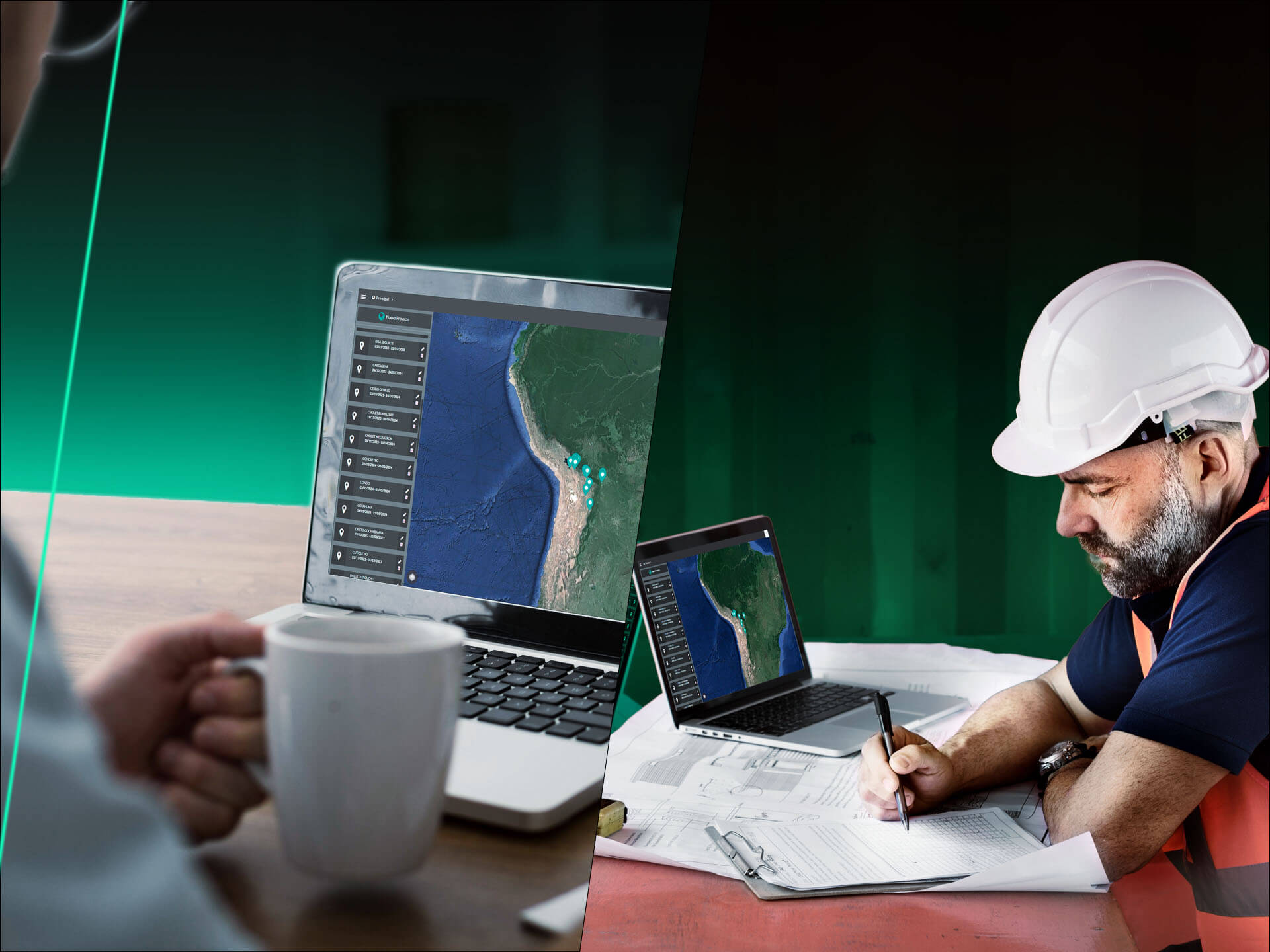
Home / Platform
Process, analyze, and share your geospatial data from the cloud.
We simplify your projects, ensuring accuracy and productivity of your data in one place.
From cloud photogrammetric processing to advanced geospatial data analysis, we optimize your team collaboration.
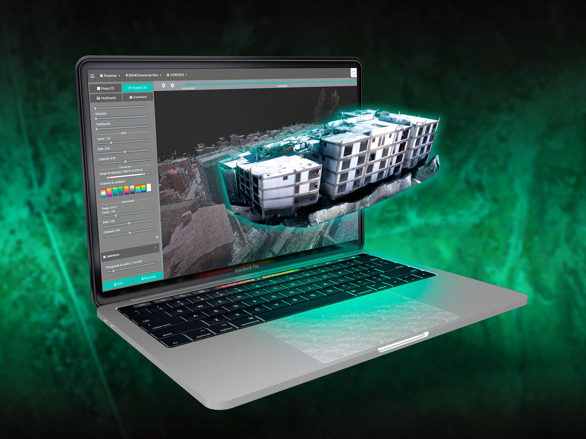
Automate your processing and turn your aerial images into professional results such as:
Do you need centimeter-level accuracy?
We are compatible with RTK, PPK systems and ground control points.
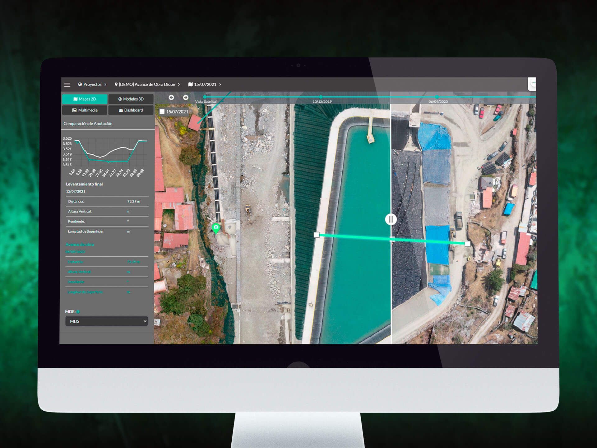
Transform your geospatial data into informed decisions with our advanced analytics tools.
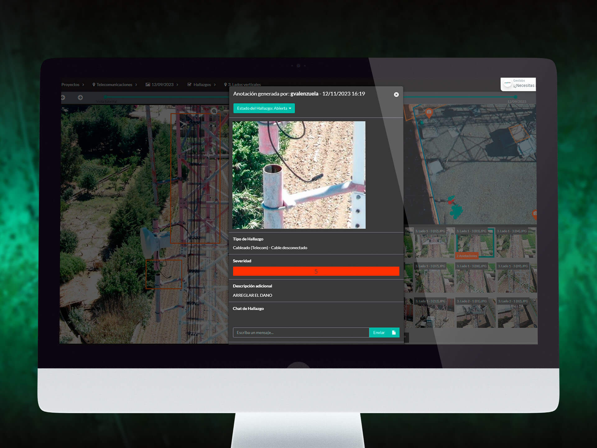
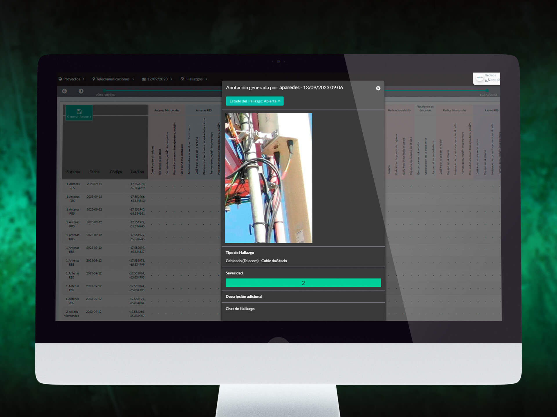
Do you have any findings that need highlighting?
Easily create and organize annotations:
Your annotations, polygons, lines, or markers provide a series of precise and easy-to-interpret measurements.
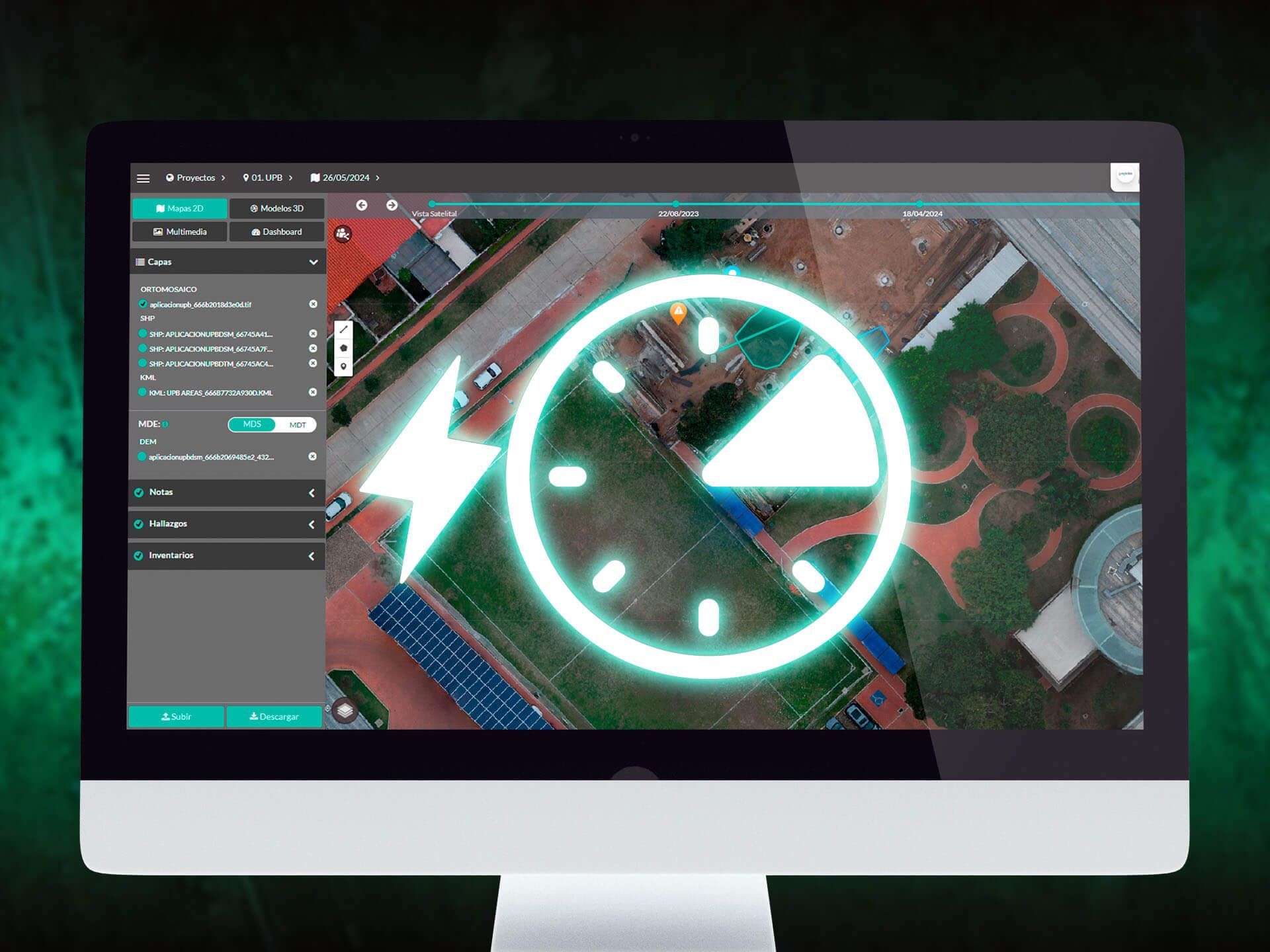
Your data gains greater value when compared over time:
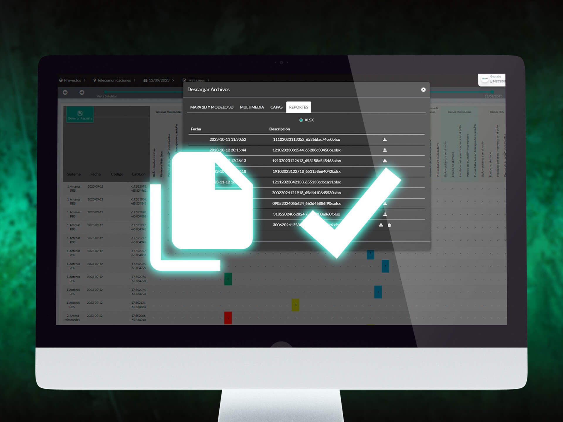
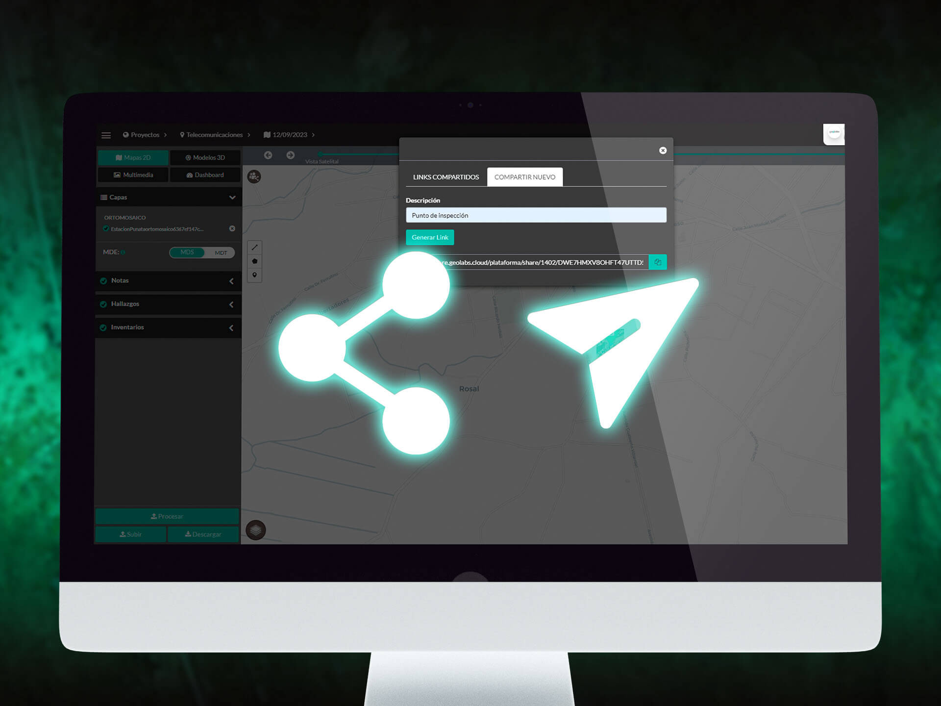
Create and share your reports, and connect in real-time with your team, external consultants, and clients using our control dashboard.
More productivity, fewer reprocesses with centralized information in one place:
We protect your information with our security solutions, including end-to-end encryption and storage redundancy.
Additionally, with our specialized technical support, you'll receive fast and efficient assistance at all times.
Please fill out the following form with your information, and we will get in touch with you as soon as possible.